We had a few days of moving house. We drove family 1’s car back to Dublin airport but we got caught up in traffic and so ended up in a mad dash with a very friendly Uber driver across Dublin to get us to the railway station for our onward train journey. Thankfully the train was running 4 minutes late so we made it by the skin of our teeth! And it’s a good job we are both feeling better as we were running from taxi to carriage with a full rucksack!
Thankfully we had a few hours to relax… and we had a tasty picnic and hot tea in our packs too. We chatted with a guy opposite, who by chance, was a walking guide in Ireland!
Our second home was about 20 minutes from Killarney and their car was waiting for us in the tiny village station car park. We stopped off at a supermarket on our way home and enjoyed a nice relaxing evening, planning the next stages of our journey.

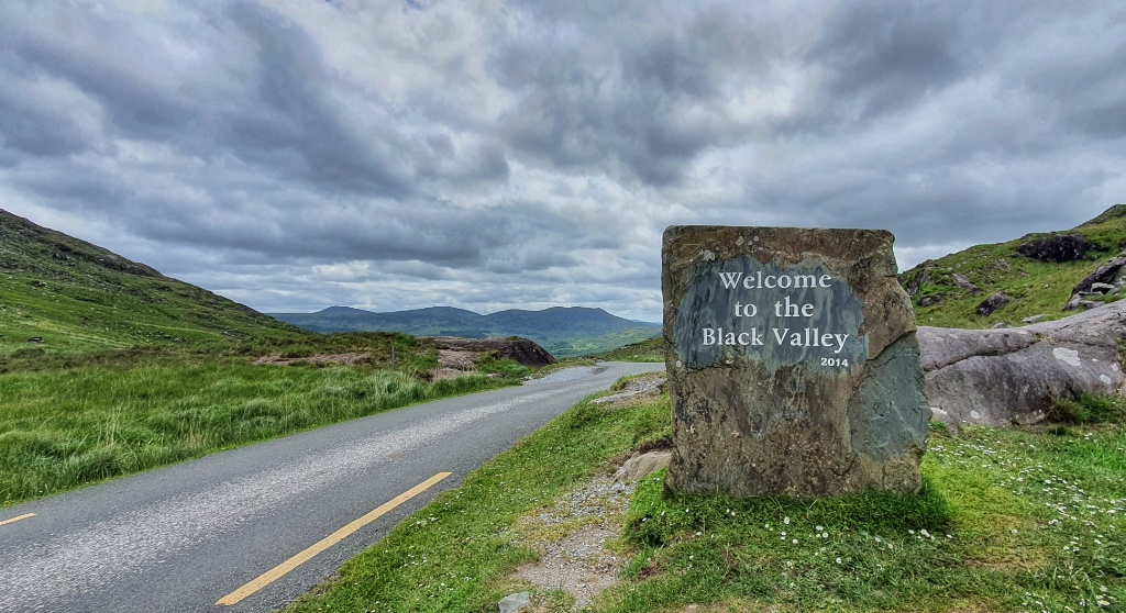
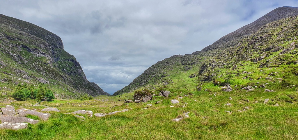
Our walking guide on the train concurred with an article that Gerry had read, that one walk we HAD to do whilst here was the Gap of Dunloe. Located about 10km west of Killarney, and visible for miles around and a stage on the Ring of Kerry, (another driving tour) the Gap of Dunloe, located between the highest mountains in Ireland, McGillycuddy Reeks and Killarney’s Purple and Tomies mountains, it has been attracting attention for centuries. Drawn by its geological significance, wealth of legends, potential for hiking and climbing, and by the sheer beauty of the surroundings, visitors flock to this unique formation every year.
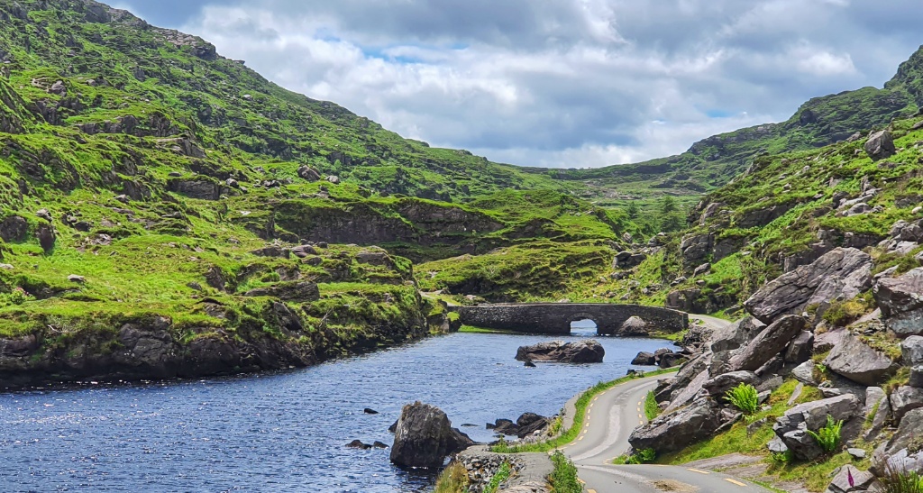
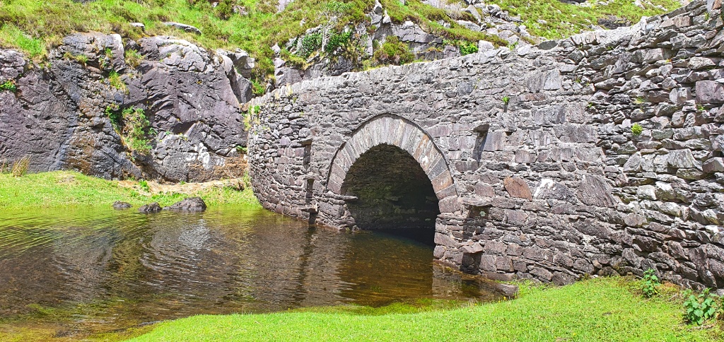
The name Gap of Dunloe comes from the Irish dun Lóich (“Lóich’s fort”), named after the chieftain of a clan who lived here in ancient times. The River Loe flows through the valley, linking its five corrie lakes: Coosaun Lough, Black Lake, Cushnavally Lake, Auger Lake, and Black Lough. When the great glaciers churned through the mountains 2 million years ago, they left massive boulders scattered about the valley,
The route starts at Kate Kearney’s Cottage in the north and ends at Lord Brandon’s Cottage in the Black Valley. The Gap was formed 25,000 years ago during Ireland’s last ice age as a result of a “glacial breach” where a glacier in the Black Valley, estimated to be over 500 metres deep!! broke through the Head of the Gap and moved northwards carving out the U-shaped valley that we see today. It reminded us a great deal of our walk up and through the Somport Pass in the Pyrenees; certainly the French side.


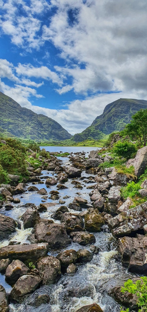
The circular loop walk is 23km and it’s a popular bucket list hike due to the incredible mountain scenery. For those less interested in the hike you can also hire a jaunting car (pony and trap), you can cycle and even drive your car through. We of course wanted to hike. However neither of us are 100% recovered and 23km over rough terrain would be asking too much of our old bones at the moment so we decided instead to forego the loop and simply hike up to the head of the Gap and then turn tail and hike back… a total of 12 kms.
Before we walked we stopped at Kate Kearney’s Cottage come cafe and had a late breakfast, and they made me a special gluten free toasted sandwich and coffee with almond milk… fabulous! Once we’d eaten our fill and checked the route we set off.


What can we say… it really is a spectacular walk. We gained nearly 300m in elevation but I’m still strong from Spain (regardless of my IBD flare) so I didn’t notice and the scenery was more than enough to distract us!
We stopped a couple of times for a cup of hot tea and a hard boiled egg. Gerry searched for fish in the lakes and streams and I took photos of sheep and foxgloves and reflections on the water. It was glorious. The weather man had said rain today but we never felt a drop. If you’re ever in County Kerry we would thoroughly recommend this glorious little trail. Maybe one day we’ll come back and walk the loop, I can imagine it’s quite spectacular!